
I left around 1:30 and took a taxi across the valley to the village of Siu Lek Yuen.

I wanted to hike east up the hill to the ridge-line between Shatin Valley and Sai Kung / Clearwater Bay. I thought I'd join section 5 of the Maclehose Trail and go north-west towards Ma On Shan or south-west towards Tates Cairn

It was about 32 degrees and about 60% humidity but nice and shaded for most of the way up.

Looking back west to Fo Tan (the towers of Royal Ascot at the right rear)

I hit the ridge about 2:45 and could have continued over and down through the forest to meet the MacLehose trail (which goes around the outside of Buffalo Hill). Instead I followed a small track north straight up the hill. This was tough going in the heat and sun, but there was a nice breeze and I was soon at the summit enjoying magnificent views.
This is the view from Buffalo Hill (606m) looking south-west towards Lion Rock and Beacon Hill with Lantau Island in the distance. You can just see the top of ICC poking over the ridge-line (far left)

Looking south-east across Port Shelter and Clearwater Bay

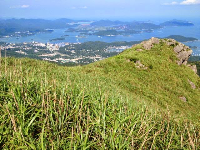
East across Sai Kung Inner Port Shelter

Video Panorama: View from Buffalo Hill (south-west-north-south)
I followed the ridge line north-west to another peak (West Bufallo Hill 604m?). This is the view looking East over Sai Kung with High Island Reservoir and Sai Kung West Country Park in the distance (far left)
And looking north to Tolo Harbor (below). From here I could have gone back or taken a path down (east) to join the MacLehose trail. But I could also see a clear path going north-west down along the ridge-line. Although it wasn't marked on my map, it was clearly a route down to the road at Mui Tze Lam. So I confidently set off down the hill through the grass.

I soon ran into an old problem from hiking in NZ when a clear highway in the intended direction branches-off and dwindles to a small track that is probably only used by sheep (or burmese pythons).
This is the view looking back-up the 'trail' towards Buffalo Hill. Only a bit of pink plastic tied to some bushes every 200m or so confirmed I was still on the path. The grass was very thick in places so I felt obliged to proceed with a stompy sort of gait and hope any snakes would wake up and slither away instead of biting my ankles.
I later read in the government safety tips for hiking: "Common venomous snakes in Hong Kong include Banded Krait, Many-banded Krait, King Cobra, Chines Cobra, Bamboo Snake. They are more active in spring, summer and autumn. Safety Guidelines: Wear long trousers and ankle boots. Use maintained paths, never venture new path and avoid hiking in dense woodland or tall underbrush" (AFCD link).


There were many mountain flowers decorating the route.

I made slow progress down the ridge-line to a steep divide overlooking the Mui Tze Lam valley.

The other side of the ridge looked down to Siu Lek Yuen from where Id started. So I headed down that way. The path was steep and covered by small round rocks like marbles, and I slipped-over repeatedly and lightly sprained both wrists as I broke my fall. Another reason why sane hikers in HK stick to marked trails.

The track was quite faint but I followed it down to some old graves by the tree-line and then followed the access track through the forest to the village. I finished around 5pm and took a mini-bus to Shatin New Town to meet Rika and Hannah for dinner.

Pavilion at the start of the trail between Siu Lek Yuen and Mui Tze Lam.

Precaution against heat-stroke. I consumed 2.5l in 3hrs with 500ml to spare.

No comments:
Post a Comment