 |
| Mr A. |
The weather was forecast to be good for the first weekend in a while. Mr A was a Hong Kong hiking virgin, so I had to promise to be a gentle. Just a relaxed stroll over the low pass from Shatin to Sai Kung... But of course, I intended to quietly test his boundaries. With a bit of luck I'd have him butt-naked on the summit of Ma On Shan by lunchtime (metaphorically speaking).
 |
| Mui Tze Lam |
We started at 8am and took a taxi to Mui Tze Lam, a small village near Ma On Shan, about 2km up a valley off the Sha Tin river (elevation 150m).
 |
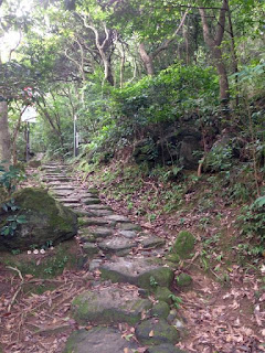
| Ancient highway through Fung Shui Wood at Mui Tze Lam |
 |
| Abandoned stone house |
Before the New Territories was developed with modern roads, Mui Tze Lam was on a main pathway between Shatin and Sai Kung, since it was easier to walk over the pass than around the coast. (similar to Japan's network of ancient mountain pathways as described in Alan Booth's famous book link).
 |
| Abandoned village, Mau Ping San Uk |
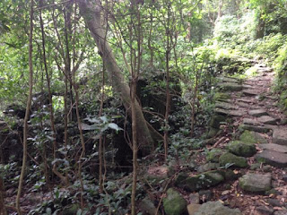
The ancient trail is paved with stones all the way, and runs up the valley past a series of abandoned villages and remains of fields and stone terraces.
 |
| Ancestral Hall, Mau Ping San Uk |
Mui Tze Lam is the only village still inhabited, although the ancestral hall at the otherwise deserted village of Mau Ping San is well maintained.
 |
| Stone path and stone terrace |
We soon reached the pass at 300m and had a break in a concrete platform in a pleasant clearing. Some local hikers told us we were sitting on the foundations of the old local school, and that children used to walk up to it every day from the local villages.
 |
| Port Shelter from the ridge |
I gently suggested to Mr A. that we might go a short distance up the MacLehose trail to get a better the view. So we hiked other 1km along the path and up to the plateau at Nong Ping (420m).
 |
| Path towards Nong Ping |
Nong Ping is a large flat grassy plateau on the top of the ridge with a terrific view east across Sai King and Port Shelter. It was very pleasant in the morning breeze, and still not yet 30 degrees.
 |
| Sai Kung from Nong Ping |
Just behind Nong Ping is Pyramid Hill (536m) and I gently suggested that we could head up there for a better view across Shatin. And after a short but tough scramble up the side-path we were enjoying a terrific 360-degree view.
 |
| Mr A on Pyramid Hill |
The air was pretty clear so we had good visibility all the way to Shenzhen where Mr A works.
 |
| Tai Po and Shenzhen from Pyramid Hill |
Panoramas from Pyramid Hill (click to enlarge)
Ma On Shan (702m) looked very inviting from Pyramid Hill, but Mr A would not be seduced any further, so we started our descent back to Nong Ping where a group of Para-gliders had started flying in the steady breeze.
 |
| Para-gliding at Nong Ping |
Video: Para-gliding from Nong Ping
We took the direct path from Nong Ping to Sai Kung, down the ridge which involved and 40 min of rock-hopping. Next time I'll take the longer way, back to the path tot he pass and then down the old stone path, which is much more pleasant for old knees.
By 12:30 we were in a cafe in Sai Kung with a cold beer. A very nice walk which I'm keen to do again. Mr A. was quite elated and said was much less painful than he'd expected. I, on the other hand, remained a little frustrated that I'd still not yet had a proper workout this summer. So I started planning my next hike, to go all the way across Lantau island.


No comments:
Post a Comment